Expert Speak | 22 December, 2025
Water Security Modelling and Drought Forecasting in the MENA Region
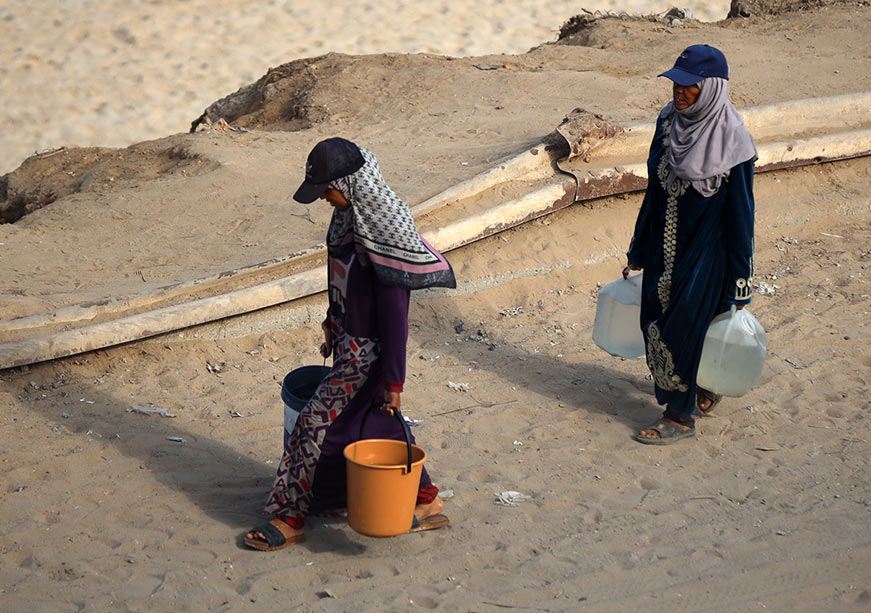
Water scarcity has shaped the Middle East and North Africa (MENA) region for millennia. This constant challenge, however, has also been a powerful catalyst for innovation, as evidenced by the ancient dams and sophisticated water management systems found across the region. Today, in an era of accelerating climate change, rapid population growth, and increasing urbanisation, the need for such innovation is more critical than ever. The MENA region is a global climate change hotspot, warming at twice the global average and facing projections of more frequent, intense and prolonged heatwaves and droughts. This environmental stress is compounded by socio-economic pressures, including some of the world’s highest population growth rates and a heavy reliance on water-intensive agriculture for food security. One of the most vital factors in navigating this complex landscape is the ability to accurately understand, predict and mitigate the impacts of droughts on water security and, consequently, on socio-economic development and geopolitical stability.
The “Day Zero” crisis in Cape Town, South Africa, serves as a stark modern example of this progression, where years of poor rainfall from 2015 to 2020 led to the near-total depletion of city reservoirs, threatening to turn off the taps for millions and causing severe economic disruption.
To frame the modern challenge, a drought is defined not simply as dryness, but as an extended period of water conditions falling significantly below the established norm for a particular area. This distinction is crucial; droughts are not unique to arid regions, as even humid areas such as those in Latin America and Indochina can also suffer from droughts if dry conditions persist. Conversely, the characteristically dry climate of the GCC is not considered a drought when it falls within normal variability. The true threat of drought unfolds through a cascading sequence of interconnected events. It begins with meteorological drought, a prolonged deficit in precipitation. If this persists, it can lead to an agricultural drought, where soil moisture becomes too low to support crops and rangelands, devastating rural livelihoods. This, in turn, can trigger a hydrological drought, characterised by a major reduction in surface water flows and groundwater levels, causing rivers, lakes, and wells to dry up. Finally, these physical water shortages can culminate in a socio-economic drought, where the disruption to water supply impacts health, social well-being, and economic activities, from energy production to industrial output. The “Day Zero” crisis in Cape Town, South Africa, serves as a stark modern example of this progression, where years of poor rainfall from 2015 to 2020 led to the near-total depletion of city reservoirs, threatening to turn off the taps for millions and causing severe economic disruption.
The Modern Toolkit for Drought Forecasting
Water scarcity modelling and drought forecasting are best understood within the broader framework of integrated water resources management. The process relies on a suite of advanced tools that transform raw data into actionable intelligence. The core challenge, especially in drought forecasting, is that its onset is often a slow, creeping phenomenon; it can take a long period of worsening conditions before a drought is officially recognised, by which time significant damage may have already occurred. Developing reliable early warning systems is therefore paramount, and a combination of advanced technologies is enhancing our ability to do just that.
Hydrological Models
These are sophisticated computer programmes that create a virtual representation of a watershed to simulate the movement of water. They vary in complexity, from simpler “black-box” algorithms that rely on statistical relationships between meteorological variables and runoff, without being explicitly grounded on physical processes, to highly complex, physically based models that simulate the intricate processes of soil infiltration, surface runoff, and groundwater recharge. Models like the Soil and Water Assessment Tool (SWAT) are particularly powerful, as they can also assess the impact of land use and agricultural practices on water quality and pollutant transport. An extensive review of over 3000 studies confirmed the immense value of using SWAT for managing water resources in arid and semi-arid irrigated watersheds common in the MENA region. Other tools, such as the Water Evaluation and Planning (WEAP) system, can operate in a forecasting mode, using meteorological forecasts to simulate how different water allocation policies would perform under future drought scenarios. Furthermore, System Dynamics modelling has been used to create interactive platforms that allow policymakers to simulate the consequences of their decisions as a virtual drought unfolds, as demonstrated by a hydro-economic model developed to manage groundwater sustainability in Abu Dhabi.
Models like the Soil and Water Assessment Tool (SWAT) are particularly powerful, as they can also assess the impact of land use and agricultural practices on water quality and pollutant transport.
Climate Models
Complementing these are global and regional climate models, which provide long-term projections of precipitation and temperature patterns that are essential for assessing future drought risk. A study using regional climate models from the RICCAR/CORDEX-MENA initiative and the Standardized Precipitation Index (SPI-3) projected significant shifts in seasonal drought patterns across the region under different greenhouse gas emissions scenarios (RCP4.5 and RCP8.5). The findings suggest that by the mid-twenty-first century, droughts are likely to intensify in the Moroccan Highlands and along the Mediterranean coast and the Mashreq region. To improve long-range forecasts, scientists also leverage teleconnection indices, which are patterns of large-scale sea surface temperature and atmospheric pressure that influence weather globally, such as the El Niño-Southern Oscillation (ENSO), the North Atlantic Oscillation (NAO), the Pacific Decadal Oscillation (PDO), and the Indian Ocean Dipole (IOD). A study in Saudi Arabia, for example, successfully linked the kingdom’s wet season to ENSO and PDO, creating a statistical basis for more reliable rainfall prediction.
Remote Sensing and Earth Observation
Perhaps the most transformative technology for drought monitoring has been satellites, which provide a continuous, wide-area view of key environmental variables, offering data for regions where ground-based measurements are sparse or inaccessible. For example, space-observed changes in vegetation health serve as a powerful leading indicator of agricultural drought, as plants in arid regions respond very quickly to a lack of rainfall. The Normalized Difference Vegetation Index (NDVI), derived from satellite imagery, is a globally used metric for monitoring vegetation health and has proven highly effective in identifying the onset and impact of drought on agriculture and pastoralism. The Food and Agriculture Organization (FAO) now provides country-level maps of NDVI to support national drought monitoring efforts. A study in Morocco showed how assimilating satellite-derived data, such as the Leaf Area Index (LAI), into land surface models like NASA’s Noah-MP could significantly improve the model’s ability to accurately represent vegetation growth and transpiration, thereby enhancing drought forecasting. Across MENA, however, the effectiveness of these tools is constrained by uneven data infrastructure, ranging from Morocco’s relatively established basin-agency networks to severe data scarcity in Yemen and parts of Libya. National security issues and weak data-sharing frameworks also limit access to transboundary aquifer information.
A landmark study using GRACE data revealed a sharp decline in groundwater storage across the Arabian Peninsula’s transboundary aquifer between 2002 and 2021, driven primarily by unsustainable agricultural extraction and urban expansion.
Beyond vegetation, the Gravity Recovery and Climate Experiment (GRACE/GRACE-FO), a joint NASA and German Aerospace Center satellite mission, has revolutionised our ability to monitor groundwater, which is a critical buffer during droughts. By measuring tiny changes in Earth’s gravity field, GRACE can track changes in large-scale water storage deep underground. A landmark study using GRACE data revealed a sharp decline in groundwater storage across the Arabian Peninsula’s transboundary aquifer between 2002 and 2021, driven primarily by unsustainable agricultural extraction and urban expansion.
Machine Learning and Artificial Intelligence
More recently, machine learning (ML) and artificial intelligence (AI) have emerged as powerful tools in drought prediction. Unlike traditional physical models, which require vast amounts of data and computational power, ML models excel at identifying complex patterns and statistical relationships within historical hydro-meteorological data to produce high-quality forecasts. Techniques like artificial neural networks (ANNs) and advanced Long Short-Term Memory (LSTM) networks are proving particularly effective. A study in Kuwait successfully used an ANN model to forecast droughts with good accuracy up to 24 months in advance. The same study has also developed an ML model that forecasts monthly urban water demand based on temperature as a proxy of extreme conditions. Another study in Iraq demonstrated the power of LSTM models, which were trained on a century-long climate record to produce a highly accurate drought outlook extending to 2060. This success stems from the model’s ability to capture the “long-term memory” in climate systems, such as slow-moving groundwater and ocean cycles, that drive drought evolution. For policy uptake, however, ML models must be paired with local technical capacity and basic interpretability measures to ensure that forecasts can be understood and trusted by water managers, especially in countries where institutional capacity is limited.
Outlook for Drought Forecasting and Water Management in MENA
Because MENA relies significantly on irrigated agriculture and food imports, improved drought forecasting has direct implications for food-system stability by enabling better crop planning, effective management of groundwater resources during dry spells, and early interventions to protect rangelands and pastoral livelihoods. Even modest gains in early warning can therefore help reduce exposure to agricultural shocks and food price volatility.
Governments must embrace adaptive management, using drought forecasts to dynamically update reservoir operations and groundwater extraction, pre-emptively adjust water allocations, and trigger mitigation plans before a crisis fully develops.
Looking ahead, the integration of these technologies into coherent policy and governance frameworks will be the defining challenge for water management in the MENA region. Four key priorities should guide this effort. First, there is an urgent need to strengthen data infrastructure, investing in both on-the-ground meteorological stations and regional data-sharing platforms to improve the accuracy of early warning systems. Second, the region must advance integrated modelling, developing frameworks that link hydrology, climate, agriculture, and economics to provide policymakers with a holistic view of how drought can cascade through their societies and economies. Third, governments must embrace adaptive management, using drought forecasts to dynamically update reservoir operations and groundwater extraction, pre-emptively adjust water allocations, and trigger mitigation plans before a crisis fully develops. Fourth, climate adaptation must be mainstreamed into all long-term planning, ensuring that new infrastructure projects and agricultural policies are designed to be resilient to the more frequent and intense droughts projected for the future.
Ultimately, the science and technology for forecasting drought are advancing at a remarkable pace. The enduring challenge, as it has been for millennia, lies in translating that knowledge into effective governance, proactive policy, and forward-looking investments to secure a water-resilient future for all.
Hamed Assaf is the Dean of the School of Engineering and Computing at the American University of Ras Al Khaimah.